
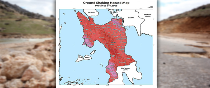
Eastern VisayaS is facing a significant geological threat, situated precariously at the dangerous intersection of the Pacific Ring of Fire, the deep Philippine Trench, and a network of active seismic faults.
A looming inevitability
Experts warn that for the coastal communities of the region, the next major offshore earthquake is not a distant possibility but an imminent inevitability.
Eastern Visayas, a region known for its rich coastlines and close-knit communities, remains highly vulnerable to geological hazards.
Philippine Institute of Volcanology and Seismology (Phivolcs) Science research analyst Myra Dolina in Eastern Visayas confirmed to THE VANGUARD that the region is not only seismically active, but it’s also one of the most at-risk areas in the country.
Eastern Visayas lies at the intersection of the Philippine Trench and multiple fault systems. These geological features, according to Dolina, are part of the Pacific Ring of Fire, a belt of volcanoes and fault lines that circles the Pacific Ocean and produces most of the world’s largest earthquakes and volcanic eruptions.
Coastal communities on the frontline
Numerous coastal towns and islands across the region face imminent danger. In Eastern Samar, towns such as Guiuan, Borongan, Salcedo, Hernani, Lawaan, Mercedes, Balangiga, Taft, Dolores, and Can-avid lie just a few kilometers from the Philippine Trench.
Likewise, towns in Leyte and Southern Leyte-such as Abuyog, Mac Arthur, San Ricardo, Hinunangan, Silago, St. Bernard and Liloan, are similarly exposed, not only to powerful tremors but also to the destructive threat of tsunamis.
“If a major earthquake strikes offshore, we may have less than 10 minutes before the first wave arrives,” Dolina warns residents in these coastal zones.
“There is no time to hesitate. Every second counts,” she said.
The danger beneath the ground
The danger isn’t limited to the sea. Beneath the ground, the Philippine fault line cuts across many inland towns such as Ormoc, Kananga, Burauen, Jaro and Mahaplag in Leyte, as well as Sogod, St. Bernard and San Ricardo in Southern Leyte.
Phivolcs data indicate that these faults remain active and have the potential to trigger powerful earthquakes.
Several of these towns have already endured devastating quakes, resulting in cracked roads, damaged bridges and tragic loss of life.
In response to the threat, local government units (LGUs) have been taking action, though challenges remain.
Leyte Provincial Disaster Risk Reduction Management Office (PDRRMO) officer Engr. Arvin Monge has introduced monitoring systems in high-risk towns, and regular earthquake and tsunami drills have become routine in many communities.
Schools regularly conduct simulation exercises, evacuation routes and signage have been improved, and barangay officials are undergoing training on rapid response and early warning protocols.
“We can’t predict when earthquakes will happen, but we can anticipate how people will react. That’s why preparation is crucial,” Monge explains.
Island vulnerabilities and communication gaps
Smaller islands like Homonhon and Suluan in Eastern Samar face vulnerabilities.
Limited infrastructure, slower communications, and the physical challenge of evacuation by sea all make response efforts more difficult.
“Our communication depends entirely on network signals,” said Carmi Macapagao, president of Homonhon Environmental Advocates and Rights Defenders (HEARD).
“Without a signal, we have no way to connect.” She added that the radio system set up by an NGO is no longer operational.
Emergency protocols in Homonhon Island are also lacking or non-functional. Community drills are scarce, mostly limited to schools. Evacuation centers are primarily schools, barangay halls and a few concrete homes.
In times of crisis, residents largely depend on advisories posted on the NDRRMC’s Facebook page.
A call for readiness
For experts and residents, the pressing question is no longer if a major earthquake will strike, but when. With tectonic pressure building beneath the region, the call for readiness grows louder.
According to Macapagao, awareness and preparedness are the only defenses against nature’s uncertainties. ‘We hope our Quick Response Teams become fully operational and that emergency communication protocols are established,” she said.

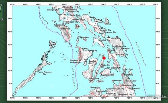 Magnitude 5.4 Earthquake Hits Cebu; Felt Across Visayas Including Tacloban — PHIVOLCS
  PSA Eastern Visayas Joins 1st Quarter Nationwide Earthquake Drill
 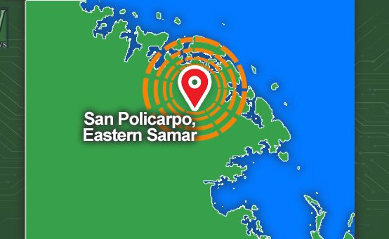 PHIVOLCS Records Series of Earthquakes Near San Policarpo
  Northern Samar Communities Enhance Flood Preparedness
  Northern Samar Records Zero Casualties as Super Typhoon Uwan Hits
 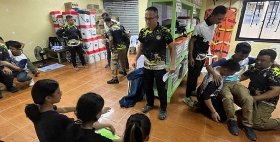 PDRRMO Boosts Disaster Readiness with BLS and Ambulance Operations Training