
 The Vanguard News
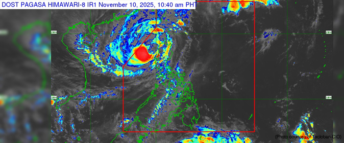
The Philippine Atmospheric, Geophysical and Astronomical Services Administration (PAGASA) said Typhoon “Uwan” weakened slightly as it moved over the West Philippine Sea on Monday, but continued to lash northern Luzon with destructive winds and a high risk of life-threatening storm surges.
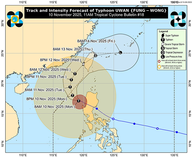
As of 10 a.m., “Uwan” was located 135 km west northwest of Bacnotan, La Union, packing maximum sustained winds of 130 km/h and gusts of up to 160 km/h moving west northwest at 20 km/h.
Several areas in the Ilocos Region remained under Tropical Cyclone Wind Signal No. 3, the second-highest level, warning of potential moderate to significant threats to life and property, in Ilocos Sur, northern and central La Union, and parts of northwestern Pangasinan.
Areas of northern and central Luzon with Wind Signal No. 2 included Batanes, Cagayan, Isabela, the Cordillera region, Ilocos Norte, the rest of La Union and Pangasinan, and provinces across Central Luzon.
Lower-level Wind Signal No.1 was in effect in Metro Manila, CALABARZON, Mimaropa, Bicol and parts of Western Visayas.
PAGASA warned of storm surges exceeding 3.0 meters in low-lying coastal areas and issued a gale warning for most of the country’s northern and western seaboards, advising all vessels to remain in port.
“Uwan” is forecast to exit the Philippine Area of Responsibility tonight or early Tuesday. — Vanguard News

