

By: Jazmin Bonifacio and Rolly Magallanes
Posted on Jan. 15, 2026 at 12:27 pm
NORTHERN SAMAR — The provincial government of Northern Samar is utilizing international experience and global standards to enhance its disaster risk reduction efforts, even as communities continue to recover from recent flooding and prepare for an approaching weather disturbance.


Rei Josiah Echano, head of the Northern Samar Provincial Disaster Risk Reduction and Management Office (PDRRMO), stated that floodwaters have subsided in 40 barangays across several towns, allowing evacuated families to return home. “We are thankful that there were no casualties in Northern Samar during the recent floods,” Echano said, highlighting ongoing communication with municipal leaders to prepare for upcoming weather changes.
Northern Samar’s disaster planning is based on the Sendai Framework for Disaster Risk Reduction (2015–2030), a United Nations‑backed international agreement that emphasizes understanding local hazards, enhancing risk governance, investing in vulnerability‑reducing measures, and improving preparedness and response capacity.
Echano explained that the province’s partnerships with international groups, including networks in Sendai, Japan, help local officials study hazard patterns and implement best practices from around the world. These collaborations support projects such as long‑term greening initiatives, early warning systems, community drills, and coordinated evacuation planning — shifting the province’s disaster approach from purely reactive to proactive risk management and resilience building.
“By integrating insights from global partners with local action, we’re empowering our communities to prepare for future storms before they strike,” Echano said.
As of January 14, 2026, the Philippine weather bureau PAGASA, has reported that Tropical Depression “Ada” is active over the Philippine Sea and is expected to affect parts of Eastern Visayas, including Northern Samar, in the upcoming days. The system has led to the issuance of Tropical Cyclone Wind Signal No. 1 over Northern Samar, Samar, Eastern Samar, Dinagat Islands, Surigao del Norte, and Surigao del Sur. Residents can anticipate winds of 39 to 61 kilometers per hour and possible intermittent rains within the next 36 hours, with rough seas along eastern seaboards. Ada is predicted to strengthen into a tropical storm within 24 hours and may pass near or over Eastern Visayas by January 16 or 17.
Authorities are advising the public, especially those in coastal and flood‑prone areas, to remain vigilant and follow safety guidelines as the situation progresses.
Northern Samar, situated in the northern part of Samar Island, spans about 3,694.96 square kilometers and has a population of 639,186 people according to the 2020 Philippine census. Its predominantly rural terrain-with dense forests, rugged hills, and low‑lying river valleys and coastal plains — makes certain areas particularly susceptible to flooding during heavy rains.
Notable flood‑prone areas include the Catubig Valley and coastal regions along the Pacific Ocean and Samar Sea, where water can swiftly inundate communities during storms.
The province comprises 24 municipalities and 569 barangays. Among the towns most likely to face flooding due to their low elevation and proximity to rivers and coastal plains are: Catarman (provincial capital), Lope de Vega, Las Navas, Silvino Lobos, San Roque, Mondragon, and Catubig.
Monitoring rivers and water levels in these areas remains a crucial part of the PDRRMO’s daily operations.
Northern Samar has implemented a series of preparedness measures:
Regular communication with town leaders to monitor changing conditions and river levels.
Collaboration with municipal disaster teams to ensure evacuation centers are prepared and stocked.
Province-wide greening initiatives to restore forest cover in watershed areas — an action expected to decrease surface runoff and long‑term flood risk, carried out with local groups and international partners from Sendai, Japan.
Emergency planning drills and early warning systems to notify residents about rising waters or approaching storms.
And strengthening of infrastructure and evacuation protocols to ensure communities can respond swiftly and safely, assisting the province in maintaining its zero flood‑related casualty record for nearly two decades.
These efforts reflect a combination of locally tailored action and adherence to global disaster risk reduction standards, strengthening Northern Samar’s resilience against current and future hazards.
(Photo courtesy: PDRRMO Northern Samar)

 Senior Citizen Shot After Alleged Stabbing Incident in Northern Samar
 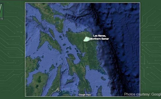 The Road to Peace: Paving Over the Roots of Conflict in Las Navas
  Silvino Lubos Pushes Growth Amid Peace Program
  Eastern Samar Teams Up with ICSC to Develop Local Energy Roadmap
  Ormoc City Secures Sixth Straight EVRAA Championship
 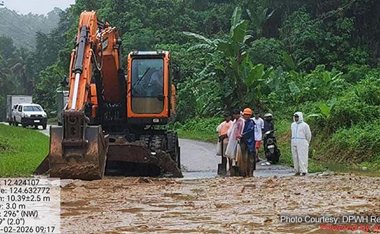 Red Rainfall Warning Triggers Flooding, Road Closures in Northern Samar